Please, hover over the image to reveal its Plan Reference Number
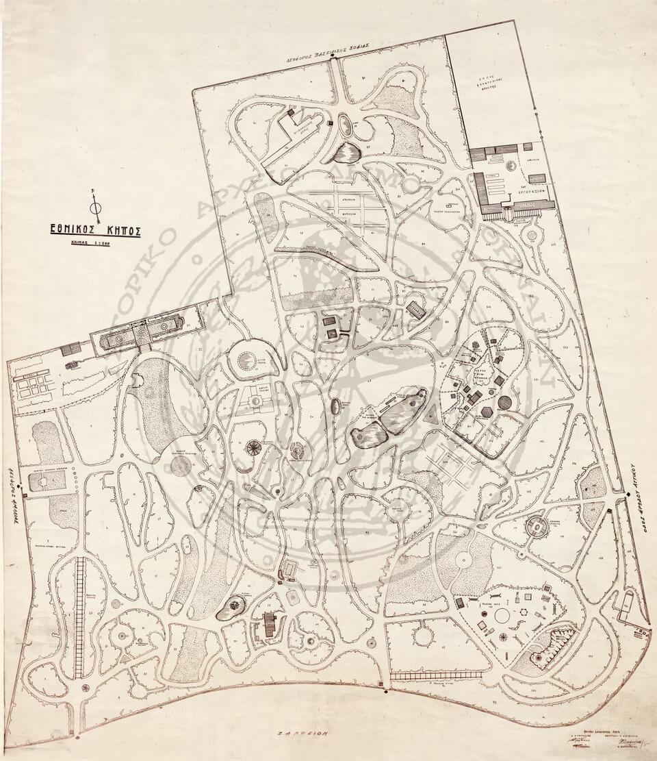
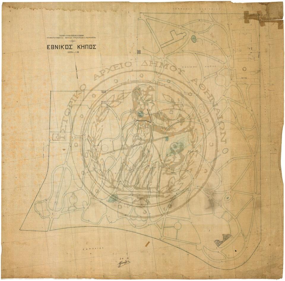
Plan No. 12. National Garden, August 1, 1931. Digital copy of a topographical plan by the Topographic Service of the Ministry of Transport – Cadastral Survey of Athens, suburbs & environs, scale 1:500, signed (illegible).
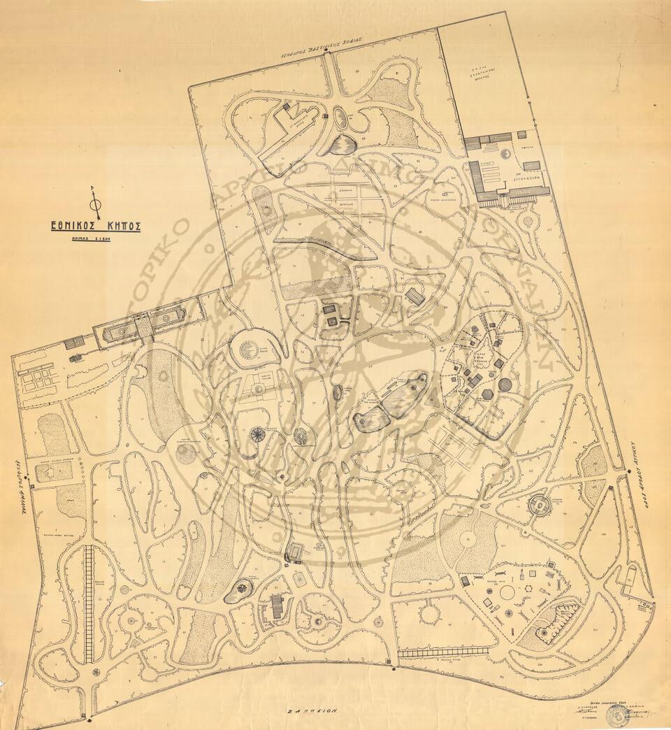
Plan No. 104. National Garden, May 1963. Topographical and landscape design plan, scale 1:500. Paper, 110×97 cm. Signed: Prepared by N. Tamvakis, Director D. Ioannidis.
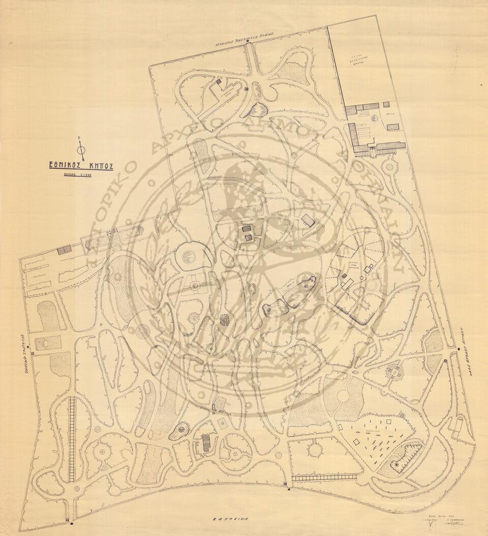
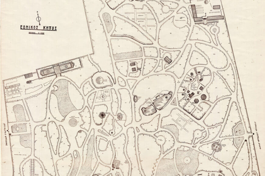
Plan No. 15. National Garden, December 1964. Topographical plan with flower bed numbering, scale 1:500. Paper, 105×96 cm. Signed: Prepared by N. Tamvakis, Director V. Mourousias. Stamp: Kingdom of Greece, Ministry of Agriculture, Committee for Public Gardens & Tree-lined Avenues.
Plan No. 102. National Garden, December 1964. Topographical and landscape design plan with flower bed numbering, scale 1:500. Ink on tracing paper (transparency), 107×94 cm. Signed: Prepared by N. Tamvakis, Director V. Mourousias.
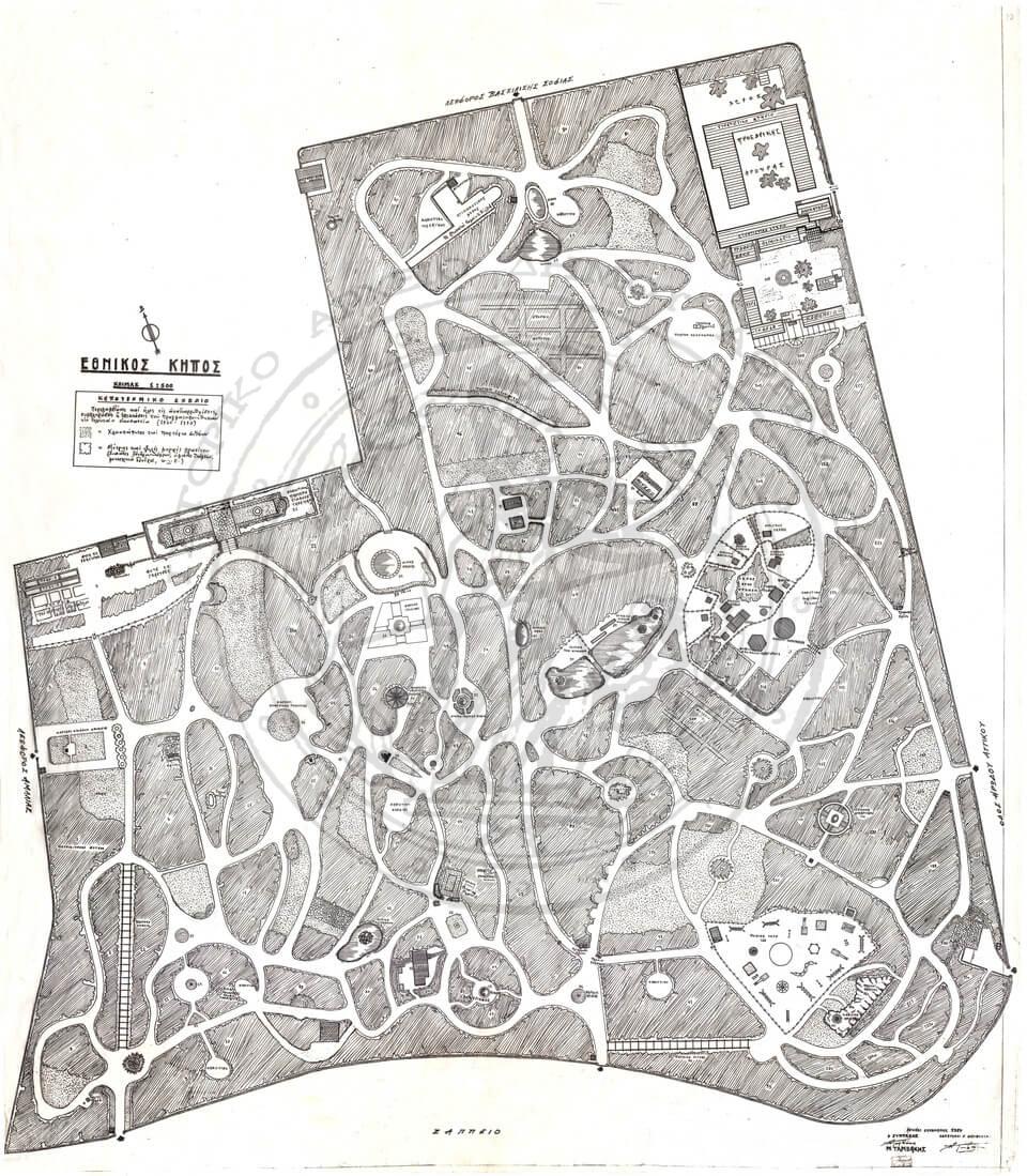
Plan No. 61. National Garden, December 1980. “National Garden. Landscape Design Plan. Includes all rearrangements, additions, or expansions carried out over the last twenty years (1960-1980)”, scale 1:500. Ink on tracing paper (transparency), 105×91 cm. Signed: Prepared by N. Tamvakis, Director N. Tamvakis.