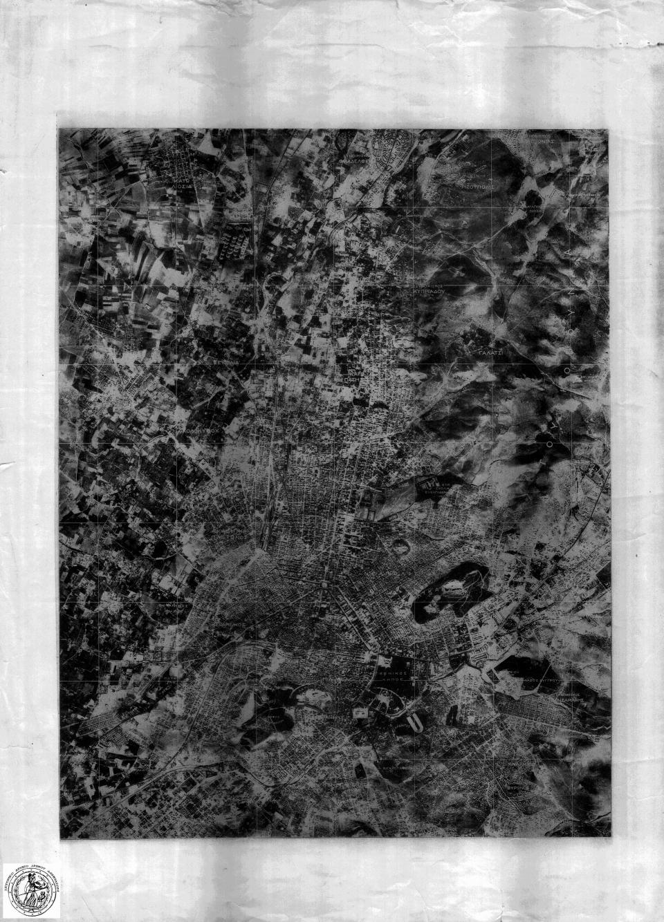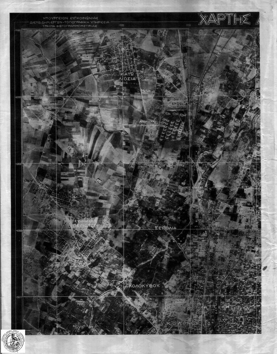
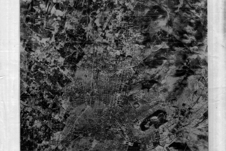
Aerial photograph of Athens, year 1929, in four sections (NE, NW, SE, SW) of A3 size and in multiple copies.
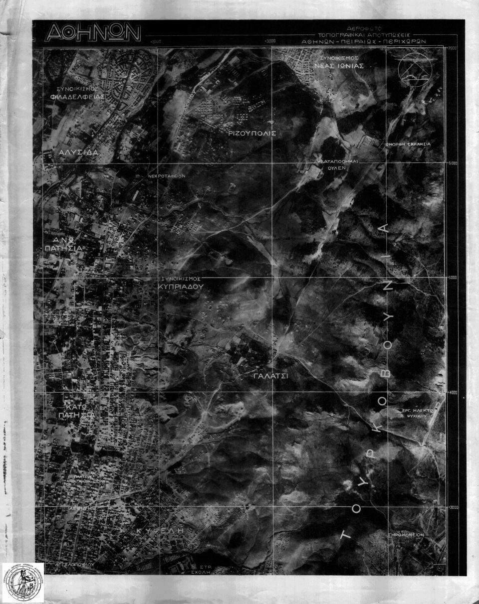
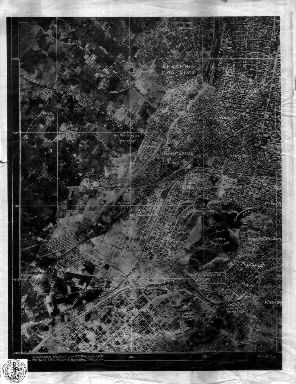
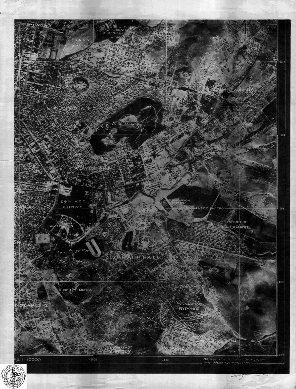
Creating Agency: Ministry of Transport – Directorate of Public Works – Topographic Service – Photogrammetry Department. Scale: 1:10,000. Material: paper. Bearing title: MAP OF ATHENS (NW and NE sections respectively) and the following additional texts:
- Top right (NE section): Aerial photo/topographic surveys of Athens – Piraeus – Environs
- Bottom left (SW section): The photographs were taken on October 10, 1929, from an altitude of 4,500 meters by an N.A.Y. airplane.
- Bottom right (SE section): Any reproduction without permission of the service is prohibited; includes initial.
The NW section exists in 7 copies, the NE in 4, the SW in 4, the SE in 4, while there is also one general view. Total items: 20.